01 · Timeline & Map
#timeline02 · The segregating city, layer by layer
#vis-2Scrub from 1900 to 2026 and watch apartheid’s spatial plan crystallise on top of the City of Cape Town’s aerial photography archive: near-annual sub-metre aerials from 1980 onward, sparser CBD-only frames back to 1926, with Esri Wayback covering 2026. Use the lower “zoom in” slider to scrub the modern era at finer resolution. Townships, forced-removal zones, informal settlements and whites-only Group Areas appear as they were proclaimed: Ndabeni 1901, Langa 1923, Nyanga 1948, Group Areas Act 1950, the Atlantic Seaboard and Southern Suburbs declared white in 1957, District Six declared white in 1966, Mitchells Plain 1971, Crossroads 1975, Khayelitsha 1983. The apartheid spatial machinery builds itself in front of you. Click any feature for its history and the source for both its boundary and its date.
03 · The spatial legacy from above
#vis-3The previous section showed the boundaries on a map. This is what one of those boundaries looks like from the air. Photographer Johnny Miller’s “Unequal Scenes” project captures the line where Bloubosrand’s gardens and swimming pools end and Kya Sands’ corrugated-iron shacks begin, separated by nothing more than a road. That road is one of the lines the 1950 Group Areas Act drew. The Act was repealed in 1991. The road is still doing what it was put there to do, sorting people by race into property and the absence of property, and a generation born after apartheid still wakes up on one side of it or the other. The data tells you the line exists. The photograph tells you the line is still working.
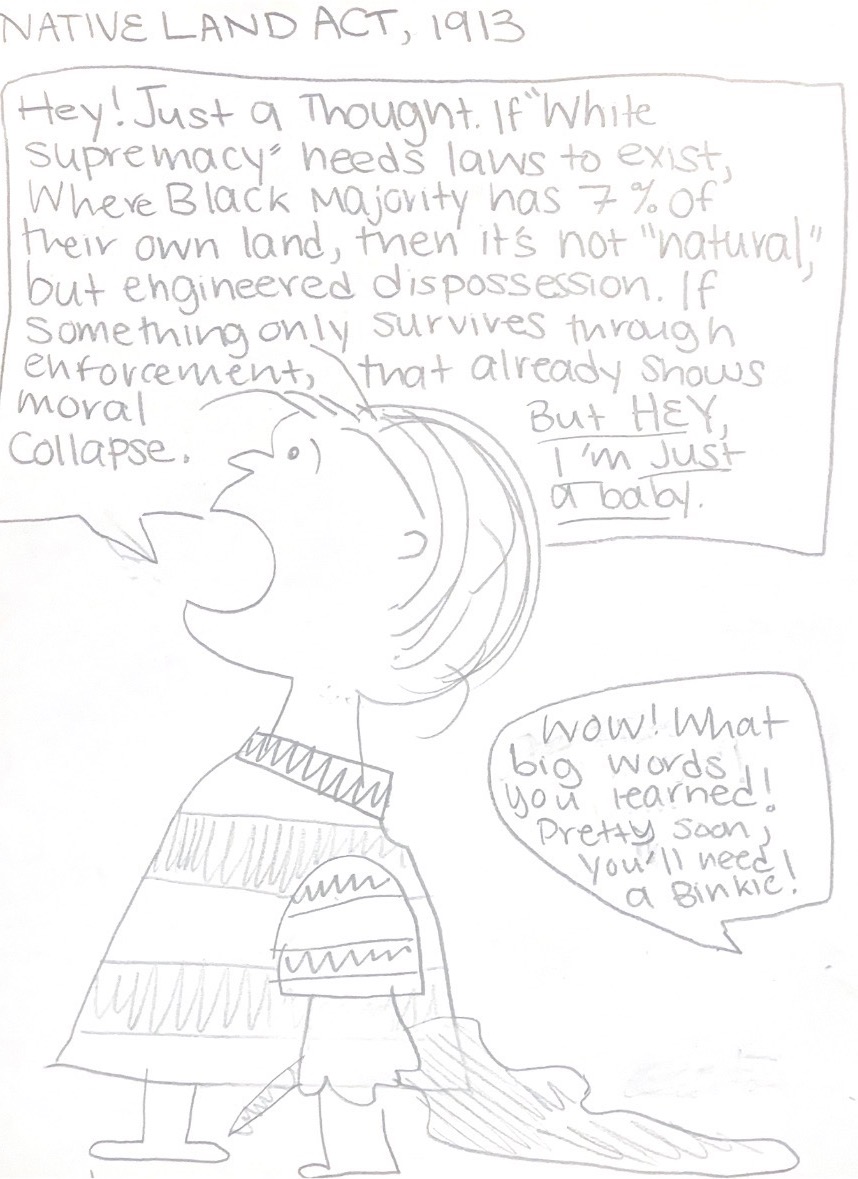
04 · Native Land Act, 1913
#vis-4A drawing about the 1913 Natives Land Act. It set aside about 7% of South Africa for the Black majority, who were already roughly two-thirds of the population, and made it illegal for them to own or rent land anywhere else. The 1936 Native Trust and Land Act later widened that allocation to about 13%. Whites, around a fifth of the population, kept the rest. If “natural” supremacy needs laws to hold it up, the sketch says, then it isn’t natural. The binkie line is how that system sounds when somebody calls it out.